Texans have a saying: "Driving across Texas isn't a trip; it's a damn career." (Driving across Texas isn't a trip; it's a damn career.)
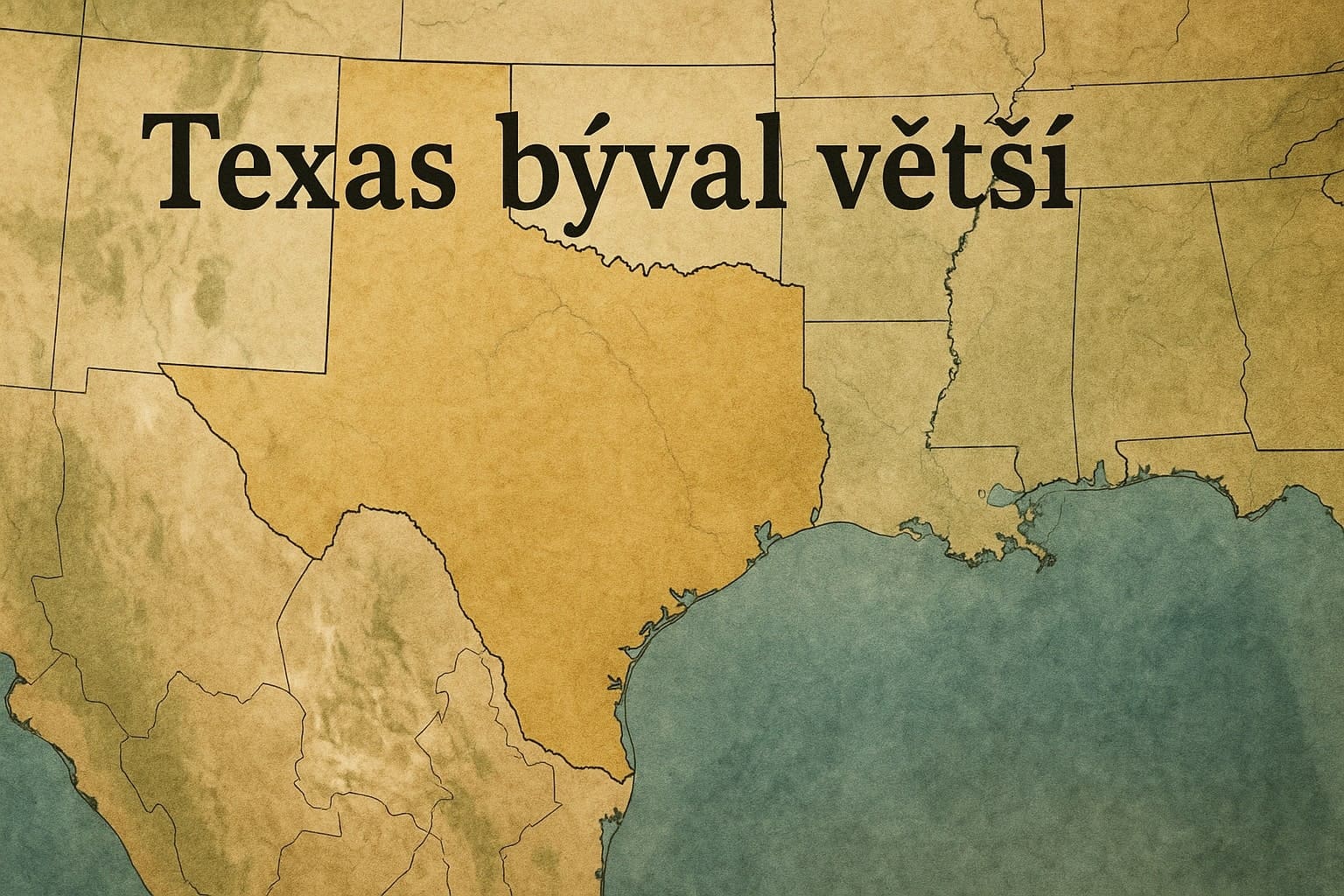
Texas is big, there is no doubt about that. But it used to be much bigger. About a quarter bigger.
When Texas joined the United States in 1845, its borders (and its shape) were completely different.
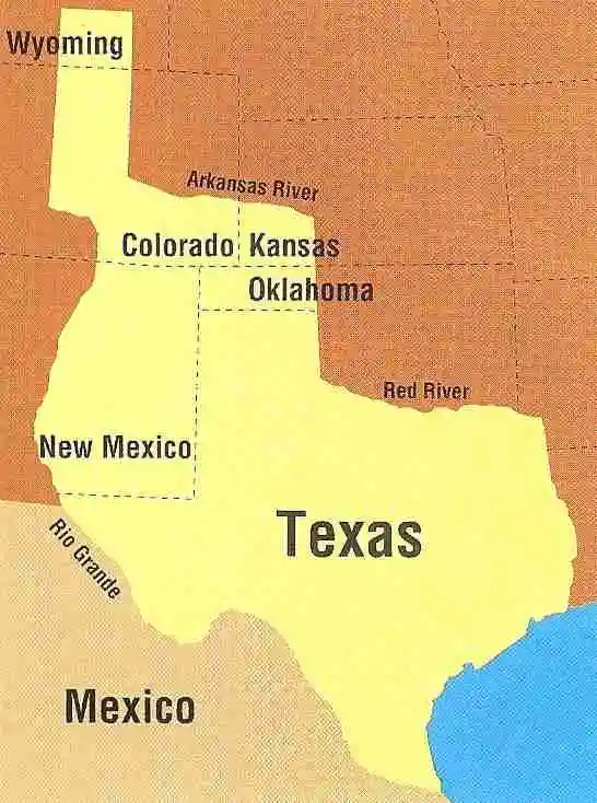
At that time, Texas's northern border extended all the way into what is now southern Wyoming. That's right. Back then, the northernmost city in Texas was not Dalhart, but Rawlins. If you think the 860 miles (1,384 km) from Brownsville to Dalhart is a long way, try imagining 1,400 miles (2,253 km) to Rawlins. In 1845, such a journey would have been measured in seasons, not days: "We'll leave in early spring and get there before winter sets in." (We'll leave in early spring and get there before winter sets in.)
Texas once had a projection extending from its present-day Panhandle (which was not really a panhandle at the time, because it was much wider and covered half of present-day New Mexico). The Panhandle projection ran through prime real estate in the Colorado Rockies (including Vail) all the way to Wyoming. They called it the "stovepipe" (stovepipe), because that was what it looked like: a long, thin stovepipe jutting northward and slightly westward above the Texas "roof" (roof), a little north of the present-day Colorado-Kansas border. You can still find remnants of Texas up there in that part of Wyoming; there is a stream called Texas Creek.
Texas also included what is now the Oklahoma Panhandle. This area now comprises three counties—Cimarron, Beaver, and Texas. So some Oklahomans still live in Texas—in Texas County, anyway.
The southwestern tip of Kansas was also part of Texas. Dodge City was in Texas. I like knowing that, because Gunsmoke always felt like a Texas show. We know that the character Marshal Matt Dillon was born in San Antonio. His father was a Texas Ranger. It all fits together.
New Mexico was about half its current size, because Santa Fe, Taos, and the entire eastern part of the state belonged to Texas. Texas was so large in 1845 that if you put a hinge at its northernmost point and flipped it northward, Brownsville would be in northern Canada beside Hudson Bay. I don't think the people of Brownsville would enjoy trading their tropical climate for tundra, but that would be the result. If you flipped Texas southward, the people of Rawlins would end up in Peru. The east-west boundaries would be closer to where they are today. Still, if you flipped Texas eastward, the residents of El Paso would trade their margaritas for mint juleps in Georgia. If you flipped it westward, the residents of Beaumont would be surfing with California surfers.
So what happened to all our territory? The U.S. government bought it in 1850. For $10 million, they bought our claims to Wyoming, Colorado, New Mexico, Kansas, and Oklahoma. That worked out to 6.7 cents per acre. It seems that we sold cheaply, but we desperately needed the money at the time. And remember, $10 million in 1850 is $300 million in today's money, which is almost enough to buy a nice vacation home in Vail.
But as I said, we truly needed the money. We had a state that needed to be built, and the only real assets we had at the time were land—and tough, hardy people with an indomitable spirit. So we sold the land, paid off our debts, and gained a much more attractive state shape, one that fits nicely on T-shirts.
And even after being reduced in size, we are no small state, especially when traveling by car. We still measure distance in time. We still feel as though we are crossing a vast frontier when we drive along I-10 through West Texas or along I-69 to the southern border. And this old Texas saying still holds true: "The sun has riz; the sun has set; and here I is in Texas yet." (The sun has risen; the sun has set; and I am still in Texas.)