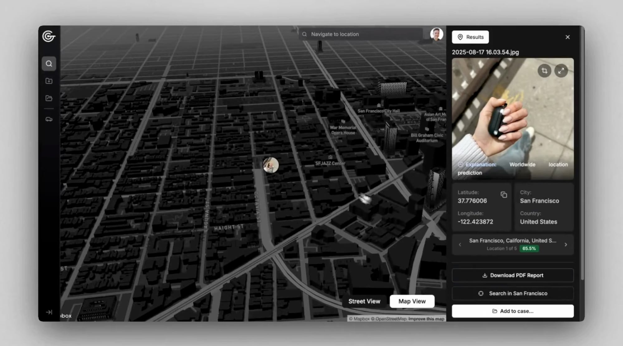
Photos without GPS data, without metadata, without any technical footprint. A seemingly anonymous shot of a street, building, or landscape. And yet— GeoSpy's artificial intelligence can determine exactly where it was taken within seconds. This is precisely what U.S. police are beginning to use when investigating criminal activity. And the story behind it is worth paying attention to.
How does GeoSpy actually work?
GeoSpy was launched in 2023 and has followed its own path from the start. While most tools rely on metadata or GPS coordinates hidden in the file, GeoSpy reads the pixels directly. It analyzes building architecture, vegetation types, soil composition, and the style of traffic signs—in short, everything the human eye perceives as background scenery but AI processes as a precise navigational key.
The result? Accuracy down to one meter. The global model can locate images from around the world, while specialized models offer even greater accuracy for specific regions. GeoSpy states on its website that it has helped solve more than 10,000 cases worldwide—and now U.S. police have purchased it as well.
Police in Miami and LA Open Their Wallets
Investigative outlet 404 Media obtained internal police emails revealing what is happening behind closed doors. The Miami-Dade Sheriff's Office (MDSO) and the Los Angeles Police Department (LAPD) have purchased GeoSpy—and plan to deploy it in criminal investigations. The total cost? More than $85,000. Specifically: two annual licenses with 350 searches for $5,000 each, another 150,000 searches for $37,500, and a specialized model for the Miami-Dade County area for $38,000. It is no small investment—but if the tool really works, the police apparently believe it is worth the money.
In an internal email, MDSO's cybercrime unit wrote that "testing shows promise for developing investigative leads by identifying geospatial and temporal patterns." Translated from police jargon: GeoSpy helps them determine where and when something happened. And this is where it gets interesting. In their internal documents, the police themselves acknowledge that GeoSpy's results should be used only as leads, not as evidence. The tool can generate false results—and that is a problem no one wants to underestimate.
Just think of Clearview AI, the facial recognition tool that became a symbol of how AI in the hands of police can cause real harm. Misidentification led to wrongful arrests. The Dutch data protection authority declared it illegal and fined it. GeoSpy has not yet directly led to any arrests—and perhaps that is precisely because the police are proceeding cautiously for now.
Privacy Under Fire from New Technologies
Are the police even allowed to use such a tool without a warrant? Where is the line between effective investigation and surveillance? These are questions that no one yet has a clear answer to—and that is precisely why the GeoSpy case resonates far beyond Florida and California.
GeoSpy targets government agencies and businesses exclusively on its website—it does not offer access to the public. Nevertheless, the fact that such technology exists and works changes our perception of what a photograph actually reveals. Every shot shared on social media, every image sent through a messaging app—all of it can be read like a map by trained AI. And in the hands of responsible investigators, it can save lives, help find missing persons, or catch dangerous criminals.